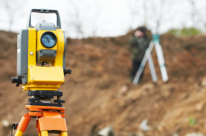
 A property survey Frisco TX is used by homeowners, municipalities, and construction companies to determine boundaries between properties. Land and property surveyors use several techniques to determine property lines, establish building placement, make charts or maps, or perform other survey applications. Land surveys fall into three basic categories: engineering surveys for building construction, information-seeking surveys to create charts, reports or maps, and general land surveys to fix property boundaries or determine land area.
Property Survey Frisco TX: Geodetic Vs. Plane Survey
A geodetic survey examines a large area of land, and the surveyor makes corrections to the measurements to account for the earth’s curvature. These surveys are exacting and property surveyors use trilateration, triangulation or astronomical direction fixing methods to clarify land dimensions.
Plane surveys cover small areas, and they treat the earth as a flat surface, with curvature not considered. Surveyors use plane geometry and plane trigonometry when measuring small tracts of land.
Surveying Frisco TX: Survey Methods
Triangulation, the most frequently used land survey method, uses overlapping, connected triangles, from which angles are then measured. This method reduces the measurements a surveyor has to make.
Trilateration measures the sides and length of triangles with electronic measuring equipment. These measurements are then used to calculate angles. This method is used in rough or hilly terrain where triangulation surveying doesn’t yield the most accurate results.
Leveling pinpoints the difference in elevation in a given area by calculating vertical distances with a leveling instrument. Theodolites are the most popular leveling instruments. A theodolite is a rotating telescope that measures horizontal and vertical angles. Theodolites may be transit or non-transit. A transit theodolite has a telescope the surveyor can invert in the vertical plane, and a non-transit theodolite has rotation restricted to a semi-circle. The surveyor uses trigonometry to determine the elevation between two points.
The traverse survey method consists of lines with measured distances and lengths connected by points. These traverse lines may be open or closed and are adjusted for detours around obstacles or rocky terrain. The traverse method is used for an exploratory survey to build new roads or streets.
The radiation property survey method is commonly used with a plane table. The land surveyor takes points at the boundary of a particular area. The points are drawn on a piece of paper and distances converted to scale on the survey report. Radiation is often used with triangulation and traverse survey methods.
If you want to build a new home or business on your land, call John Cowan and Associates for a property survey Frisco, TX at (972) 635-4300 to prevent construction and boundary problems.
Property Survey Frisco TX
John Cowan & Associates
10147 CR 135
, Texas 75762
(903) 581-2238
Photo Credit: Depositphotos.com/ kalinovsky
